

Table of Contents
This page is the record of one borehole drilling in Ithaga project. An 8-acre farm, and a client living in the UK. The hole was planned at 180 metres and finished at 210. First, the brief and the land. Then the permission trail, the rock and the extra metres. Then the rig access, the test pumping and the paperwork that keeps the water legal. Use it as a checklist for your own site. Borehole drilling in Ithaga went the way most highland Murang’a jobs go. Good water, slow ground, and a depth nobody quotes at the start.
Borehole Drilling in Ithaga: the project record
The client buys the land from abroad and farms it through a manager on the ground. That shape of project is common here, and it changes what the borehole has to deliver. Nobody stands in the field to judge a trickle. The pump has to fill a tank and the tank has to feed irrigation. The irrigation has to carry crops through a dry month without a phone call to the UK. So borehole drilling in Ithaga was scoped as a farm water supply, not a domestic hole.
Eight acres is the commandable area. In metric that is 32,375 square metres, or just over three hectares. The farm plan called for year-round crops. That means water in January and in August, the two months a highland rainfall record cannot be trusted. Because the whole layout depends on the hole, the survey came first and the rig came last. That order is the cheapest decision in this business, and most clients skip it.
What the land tells you before the rig moves
Murang’a County covers 2,325.8 square kilometres of the Central Highlands, and its rivers, the Maragua, Mathioya, Kayahwe, Irati and Muriurio, all drain off Aberdare-derived ground. The fertility here comes from highland soils, not from a flood plain. In practice that means water stored in rock, not in sand. A river nearby is not a promise of a shallow hole.
Because the rain arrives on a slope, it moves. Some runs off to the rivers. Some soaks into fractures, and that fraction is what a borehole finds. Consequently the siting question is not where the water is. It is where this hillside lets water in, and where a rig can stand to reach it. A hydrogeological survey in Kenya answers both, and it answers them before a single metre is drilled. On this site the survey set the collar position, and the collar position later set the access works described below. The two are the same problem.
The permission trail behind borehole drilling in Ithaga
The live project needed four clearances, and each one arrives at a different desk. First the Water Resources Authority permit process, then an Environmental Impact Assessment approval through NEMA. Then county approval. Finally a no-objection letter from the water services provider that covers the area. Also worth knowing. The Water Act 2016 vests every water resource in the National Government, held in trust for the people of Kenya. So a borehole is licensed use of public water, not ownership of it.
The Water Resources Authority publishes its own permitting sequence, and it is longer than most clients expect. Its page on water use allocation sets out ten steps. A groundwater application gets a file number coded /G. Then public notification under Water Resources Management Rule 29, with site verification. Then technical evaluation by a committee at a regional office. Applications are sorted into categories A to D. Therefore a small farm hole and a large abstraction do not sit in the same queue. Categories C and D go through Basin Area Advisory Committees, and a D file goes on to headquarters. Borehole drilling in Ithaga was handled inside that sequence, and the paperwork below is what came out of it.
One line on that page deserves more attention than it gets. An authorization lets you build the works; it does not let you use the water. The Authority states plainly that abstracting water with authorizations is illegal. Many farmers finish a hole, switch on a pump and never convert the authorization into a permit.
Rock above water: what the hole went through
The drill passed through highland volcanic rock to reach the aquifer. The layer that mattered was not the one anyone expected. A dense rock band sat directly above the water reservoir. That is a real geological situation, not a story told to justify an invoice. The bit has to break the seal without damaging what lies under it. The yield of the finished hole depends on the fractures you just opened.
Instead of hammering straight through, the crew took the rock in controlled passes. They kept the hole stable with drilling fluid, the mud pooled at the collar in the photographs. As a result the team spent metres and hours that a flat sedimentary site would not need. Specifically, two hard facts came out of this hole: the rock barrier and the depth increase. Both were discovered after spudding, not before. Nobody who has not drilled this ridge can promise you either one in advance.
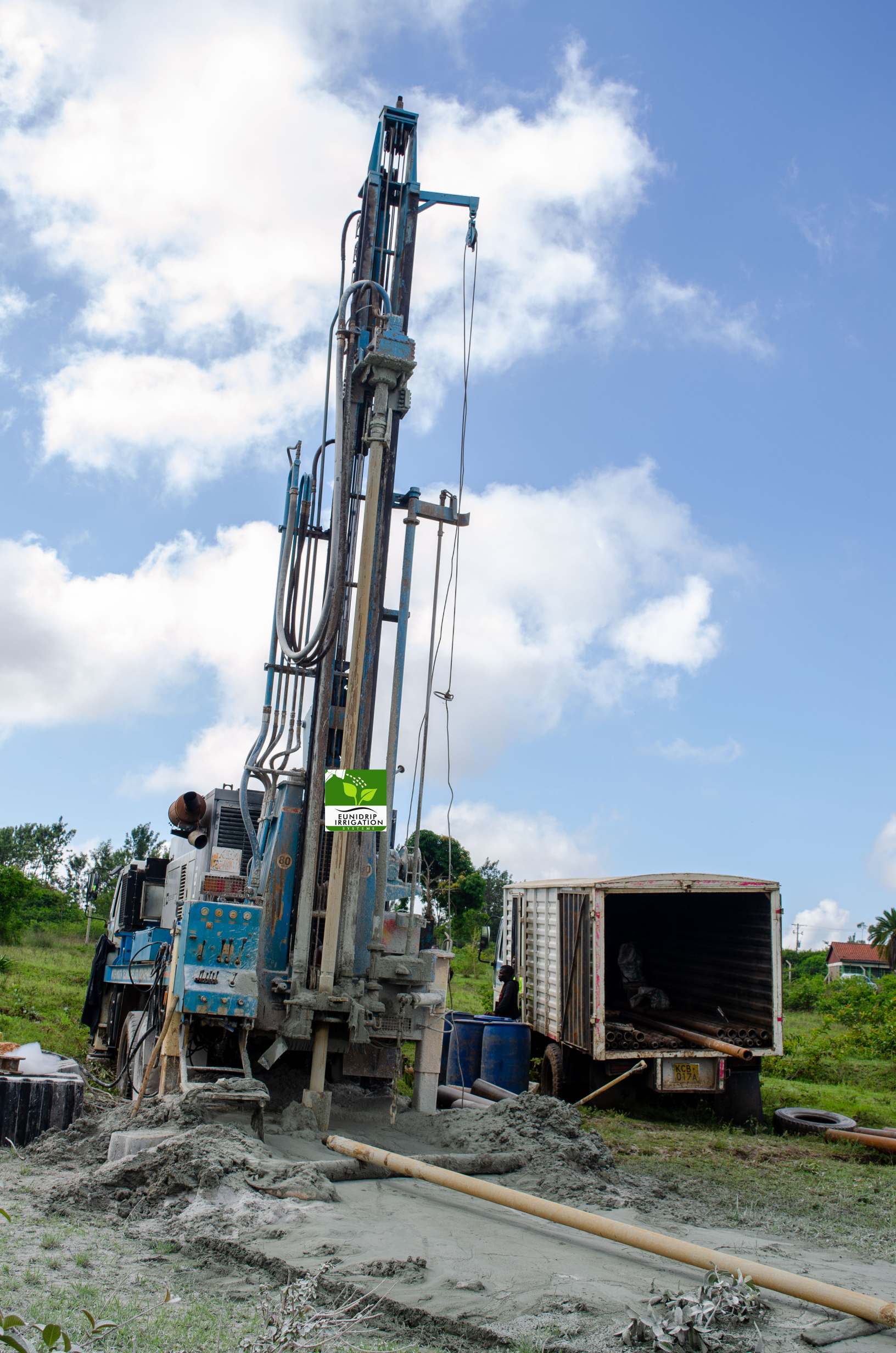
Planned 180 metres, finished at 210
The estimate on paper was 180 metres. Water came at 210. Below is the arithmetic of that gap, because the gap is what clients ask about when they compare two quotes.
| Item | Planned | Actual | Difference |
|---|---|---|---|
| Drilled depth | 180 m | 210 m | 30 m further |
| Share above the estimate | – | 16.7% | about one sixth more metres |
| Vs the county band of 150-200 m | inside the band | 10 m above the band | deeper than most Murang’a holes |
| Mobilisation of the rig | once | once | unchanged by depth |
Two things in that table are worth reading twice. The extra 30 metres is charged against drilled metres. Depth variance is the number that moves a borehole bill. Mobilisation is not: the rig arrives once whether the hole stops at 180 or runs to 210. For this reason a client who pays for the survey first is buying a better estimate, not a guarantee. Then the second point. A hole 10 metres past the top of the local band is still an ordinary Murang’a result. Treat 150-200 m as the planning range. Treat 210 m as a live possibility, not an accident.
Getting a loaded rig onto soft highland ground
A fully loaded drilling lorry is one of the heaviest vehicles to ever cross a farm, and the ground at Ithaga was soft and uneven. The crew could not bring it straight to the collar. So the team reinforced the approach, and that reinforcement is time and material nobody budgets for at the signing. Meanwhile intermittent rains softened the surface further. That raised the risk of the truck sinking beside the hole it was meant to serve.
Drainage works came next, to move runoff away from the pad instead of letting it collect under the tracks. Consequently the site stayed workable through wet weather, at the cost of hours. In practice the access problem is the one thing on this list a landowner can fix before the crew arrives. A firm, graded track to a level pad at the survey point removes the reinforcement bill. This matters most where a tilled field sits 200 metres off a murram road.
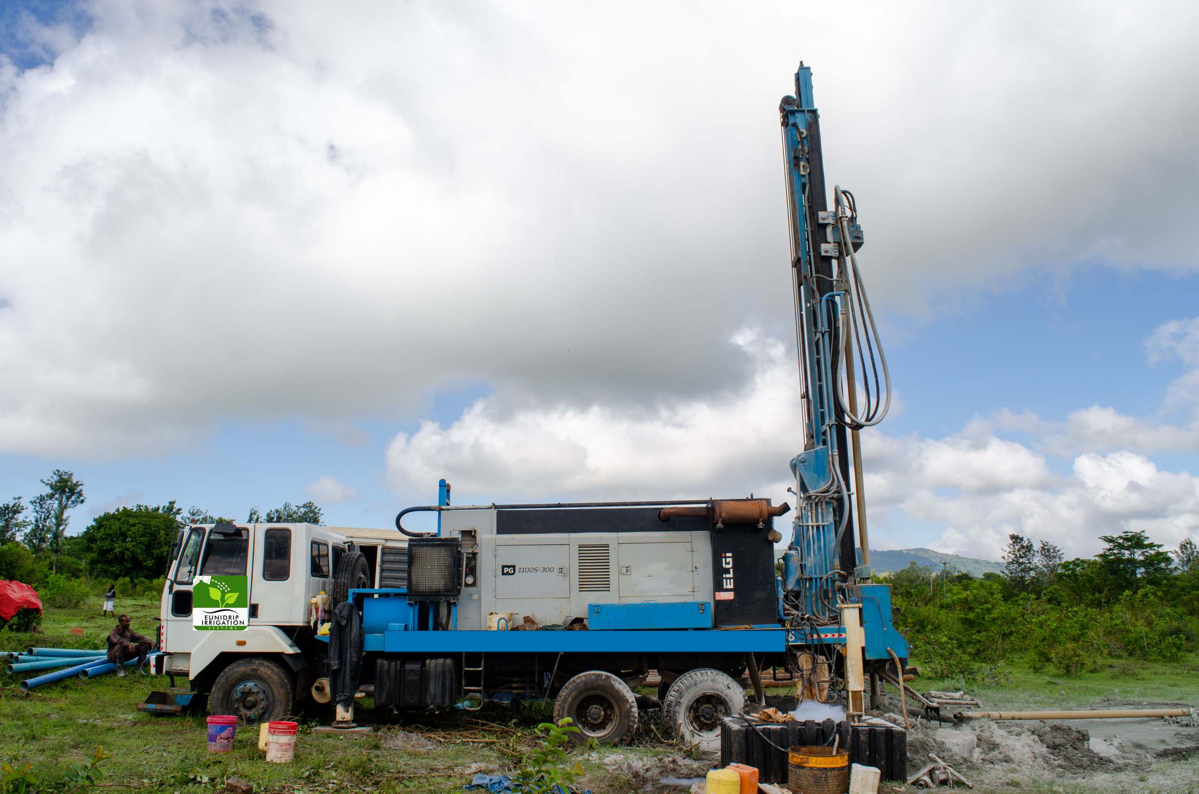
Test pumping after borehole drilling in Ithaga
Drilling ends. Test pumping starts. The crew ran the hole down to establish what it actually gives. The result was a steady supply able to carry the farm’s irrigation load. That is the sentence every client wants, and it is also the sentence most people accept too early. A test pump tells you a yield under a specific drawdown for a specific duration. It does not tell you what the hole will do in March of the third year.
Water samples went to a laboratory at the same time, and the analysis matters twice. First it protects the crop. Highland farm water can be sound for people and still wrong for a sensitive nursery. Second it is a permit requirement. The Authority’s own step 7 list asks for three documents before it issues the permit. A completion certificate, a Borehole Completion Record for groundwater applications, and a water quality analysis report. In other words the test you pay for is also the document that makes the abstraction lawful. Borehole drilling in Ithaga was handed over with that file, and a handover without it is incomplete.
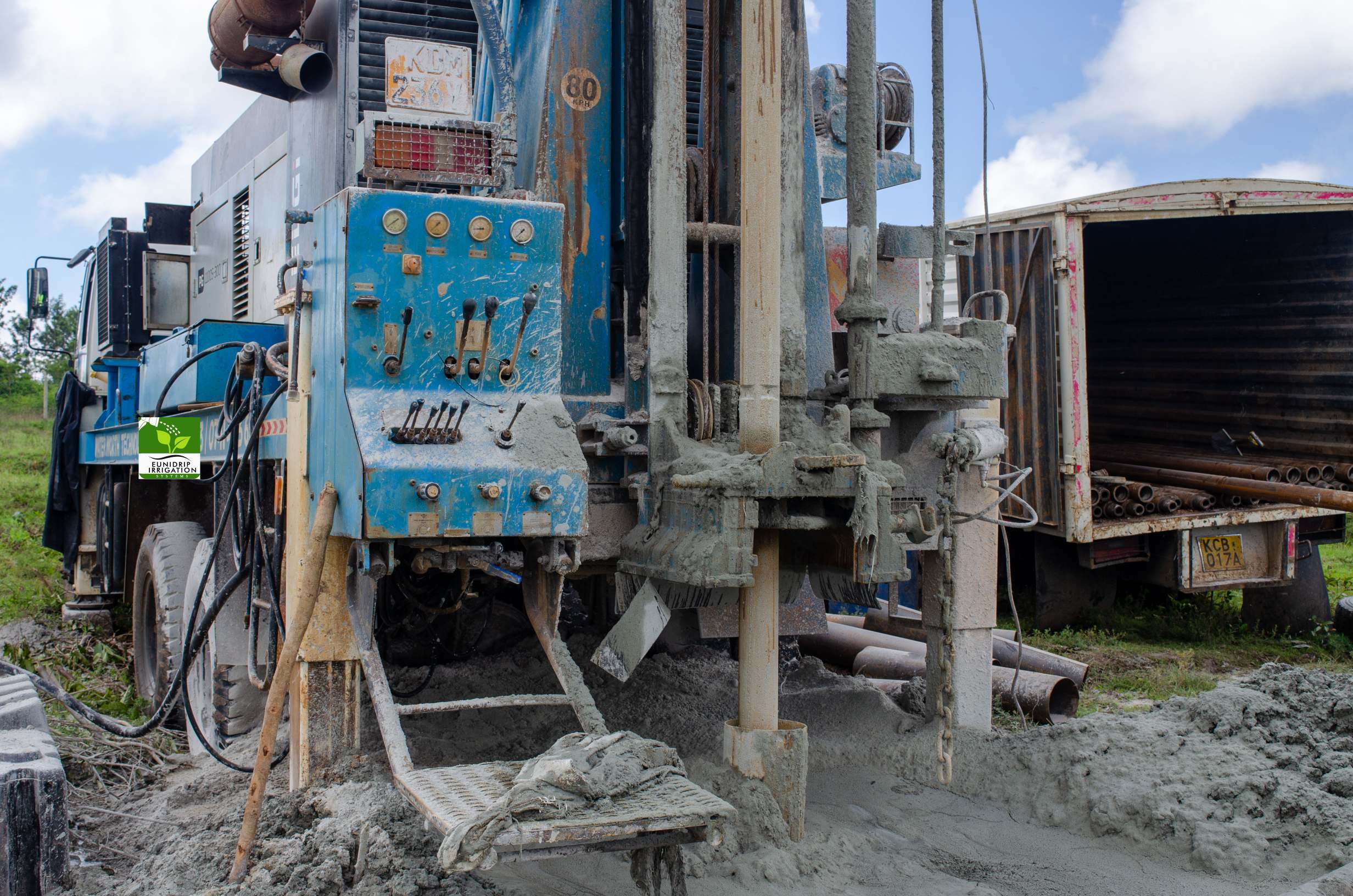
What an 8-acre farm draws from the hole
Three systems went in behind the borehole. Each had a different job on the same 32,375 square metres. Drip lines carry the rows that need water at the root and cannot tolerate wet leaves. Overhead sprinklers cover the wider blocks where a canopy of spray is cheaper to lay than line for every metre. Subsurface irrigation serves the water-sensitive crops. The goal is moisture in the root zone with nothing standing on the surface.
Because all three draw from one hole, the design question is timing, not volume. A pump that fills a tank over eight hours lets the plot irrigate in two. That is why the pump for drip irrigation is sized against the tested yield and the storage. It is not sized against the pipe you liked in a catalogue. For the emitter layout itself, the drip irrigation system work on this site covers spacing and zoning. The cost of a drip irrigation system in Kenya page carries the per-acre figures. Storage, power and the head main sit outside that number, so read the two pages together.
One more piece of farm infrastructure gets decided in the same month as the borehole. An 8-acre block with a tank, a pump house and an open water point needs to be fenced. Post spacing, wire and strainer counts are worked out on the farm fence installation in Kenya page. Water and fencing are bought from one budget, and they are usually planned in separate years.
Borehole drilling in Ithaga, Nakuru and Rumuruti: what changes
Same rig, three counties, three different conversations. The Ithaga record above is a highland hole: fractured rock, a seal to break through, soft access. On the borehole drilling in Nakuru work, the ground and the rate conversation are different again. That page carries the figures we publish there. Around a borehole drilling company in Rumuruti, the plateau decides the survey first. Everything else follows from that.
What does not change is the order of work. First the survey sets the collar. Then the permissions run while the rig is booked. Then the hole goes down, and only then does anyone talk about a pump. For this reason the county in your question is a geology question, not a price question. Our step-by-step process of borehole drilling page explains each stage in the sequence. Read it first if you have never sat through one.
The paperwork that keeps a borehole legal
Compliance does not end at the permit. The Authority lists what a compliant user must do. Install controlling and measuring devices, hold a valid permit, and pay the charges on time. Then renewal, which is a step in its own right and is missed more often than the application. Likewise an expired authorization needs an extension filed before the works are finished, not after.
The offences on the same page are worth naming, because they are ordinary farm habits. Irrigating beyond the permitted threshold is an offence. Abstracting beyond it is an offence. Drilling without an authorization from the Authority is an offence. As a result a farmer who installs a bigger pump than the permit describes has a paper problem. It sits on top of a water problem. The fix is cheap while the hole is new. The completion record, the analysis report and the measured abstraction all exist already, and a variation is a filing.
Two practical notes on the file itself. The Borehole Completion Record is specific to groundwater applications, so a surface-water permit does not carry one. A driller who has never filed one may not know what you are asking for. Also, keep the depth, the casing record and the test pumping figures in the same folder as the permit. A hole drilled in 2024 and re-licensed in 2034 is argued from that folder.
Six weeks, and what stretched them
A survey-to-handover run of 4 to 6 weeks is the normal window, that is 28 to 42 days. It assumes permissions move on schedule. This project took longer in the ground and not longer in the office. The four things that ate time are the ones to plan around.
| What happened | Where it bit | What it was avoidable by |
|---|---|---|
| Dense rock above the reservoir | Drilling days | Nothing, it is geology |
| Depth 180 m to 210 m | Drilled metres | A tighter survey, not a cheaper rig |
| Soft, uneven approach for the lorry | Site works | A graded track and a level pad |
| Intermittent rains during the hole | Stability and drainage | Season choice, partly |
Note the split. Two of those four are ground you cannot negotiate with, and two are ground a landowner can prepare. Therefore the honest promise to a client is a window, not a date. Typically the office work is the shorter half of the wait, and the hole is the longer half.
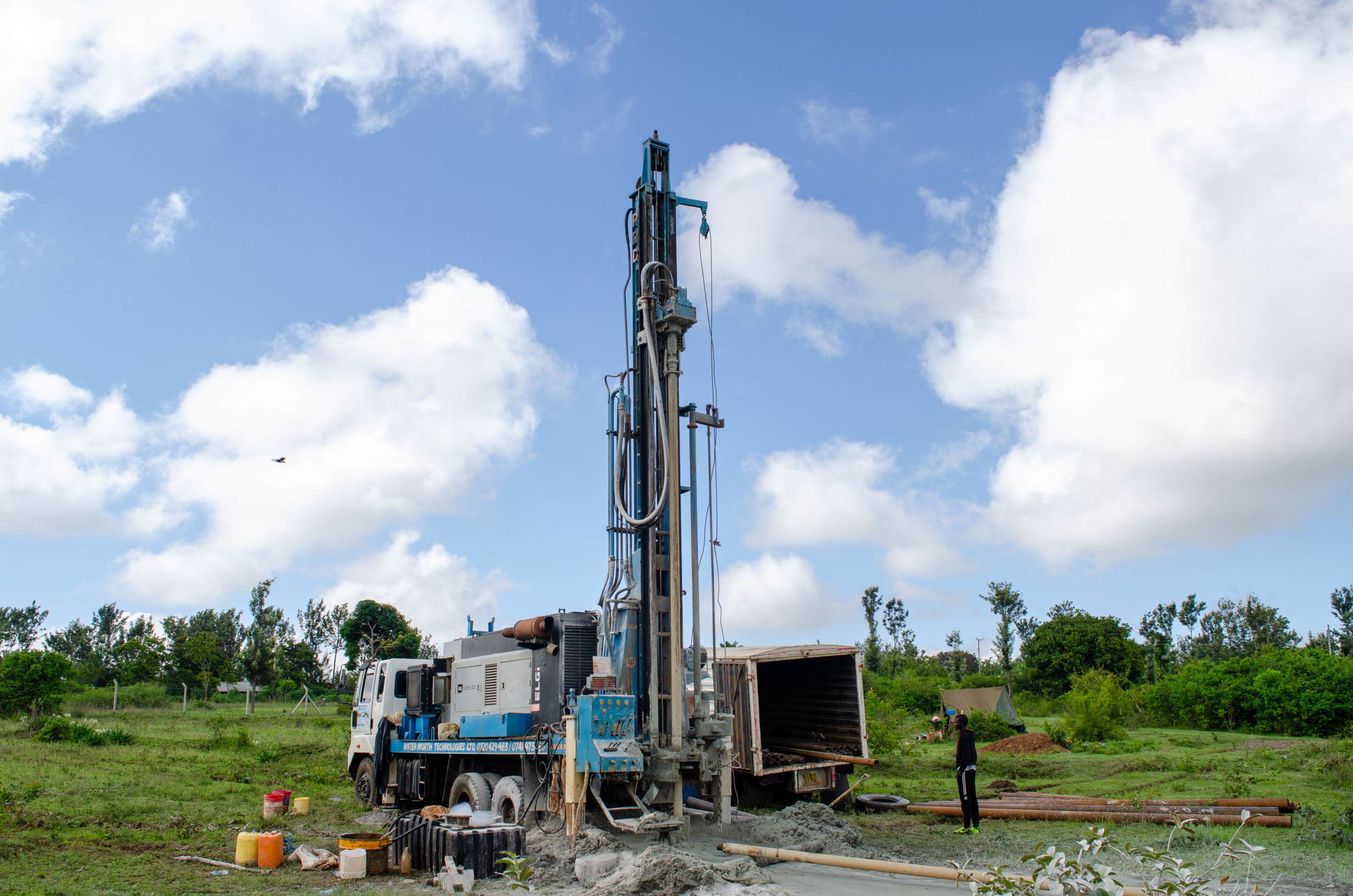
What to brief before borehole drilling in Ithaga starts
Send five things and the survey earns its fee. First, the title document or the plot coordinates. A collar inside a disputed boundary is a permit you cannot use. Second, what you intend to irrigate and in what season, since that sets the abstraction you will apply for. Third, the existing water sources: a well, a river intake or a tank scheme changes the siting logic. Fourth, how the rig reaches the site in wet weather, honestly described. Fifth, the power position, grid, solar or generator, because a pump and its starter are chosen together.
Then the two questions to ask us, not the price. Ask what depth the survey expects. Ask what the crew will do if it misses by 30 metres, as this hole did. Ask which permit category your abstraction falls into. That decides who reviews the file and how long the wait is. Borehole drilling in Ithaga was won on those two answers, and lost nowhere else.
Frequently Asked Questions about borehole drilling in Ithaga
How deep did the borehole drilling in Ithaga actually go?
The hole was planned at 180 metres and reached water at 210 metres. That is 30 metres, roughly one sixth, beyond the estimate. Most holes in this county sit between 150 and 200 metres. So 210 is deep for Murang’a, but not an outlier.
Can I pump before the permit is issued?
No. An authorization allows the works to be built; it does not allow the water to be used. The Authority states that abstracting under an authorization is illegal. The permit follows the completion record, the analysis report and the fee.
Will one 210-metre hole carry eight acres?
It did here, with storage and a pump sized to the tested yield, not the pipe. Eight acres is 32,375 square metres. The same volume spread over two hours needs a different pump than over eight. Borehole drilling in Ithaga was scoped with the tank in mind. That is why the farm irrigates in the dry months.
What documents should the driller hand over?
A completion certificate, the Borehole Completion Record, the water quality analysis report and the depth and casing log. Keep them together. The first three are what the permit file asks for. The log is what a future re-licence or a new pump is argued from.
Why did the rig need ground reinforcement?
The approach was soft and uneven, and rain arrived while the crew worked. Reinforcing the track and draining runoff off the pad kept a loaded lorry from getting stuck beside the collar. A graded, firm access built before mobilisation removes that cost.
Is water testing needed if the farm already drinks from the hole?
Yes, and twice over. The permit file requires an analysis report. Farm water that suits animals and people can still be wrong for a nursery or a sensitive crop. Testing is a document, not a formality.
Next step: book the survey
The survey is the small number at the front of a big project. It sets the collar, the expected depth band and the permit category. It is the only stage where a 30-metre surprise can still be reduced. Call 0728 163329 or 0724 775516 with the five briefing items above. The crew will tell you what this county’s ground is likely to do before a rig is booked. Borehole drilling in Ithaga is on this page because the record is useful to the next client. It is not there because 210 metres is unusual. It is what you do with the extra thirty that decides the project.